-
编译sqlite
下载地址:
SQLite Download Page
-
把sqlite-amalgamation-
XXXXX
.zip、sqlite-tools-win32-x86-
XXXXX
.zip、sqlite-dll-win32-x86-
XXXXX
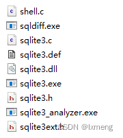
.zip三个压缩包解压至同一目录下。
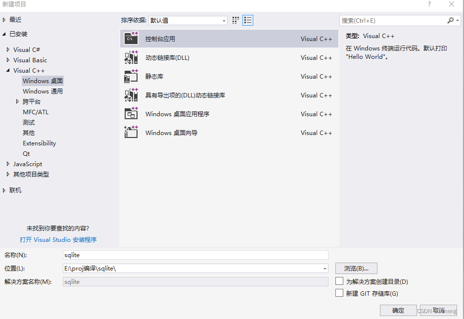
2.新建vs Win32程序,名称位sqlite,去掉”为解决方案创建目录”选项,附加选项为”空项目”。
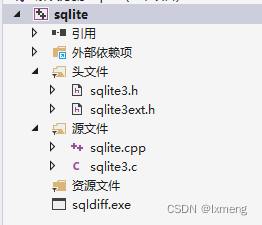
3. 添加所有.h和.cpp到工程。
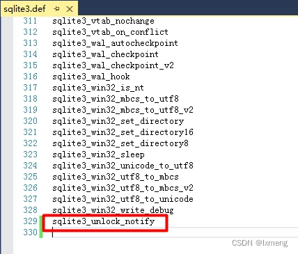
4. 修改sqlite3.def文件,在最后添加
sqlite3_unlock_notify后保存
。
5. 修改项目属性
顶部”配置”改为”所有配置”,”平台”改为”所有平台”。目的是不管Debug、Release、Win32、x64,相同部分的设置均一致。
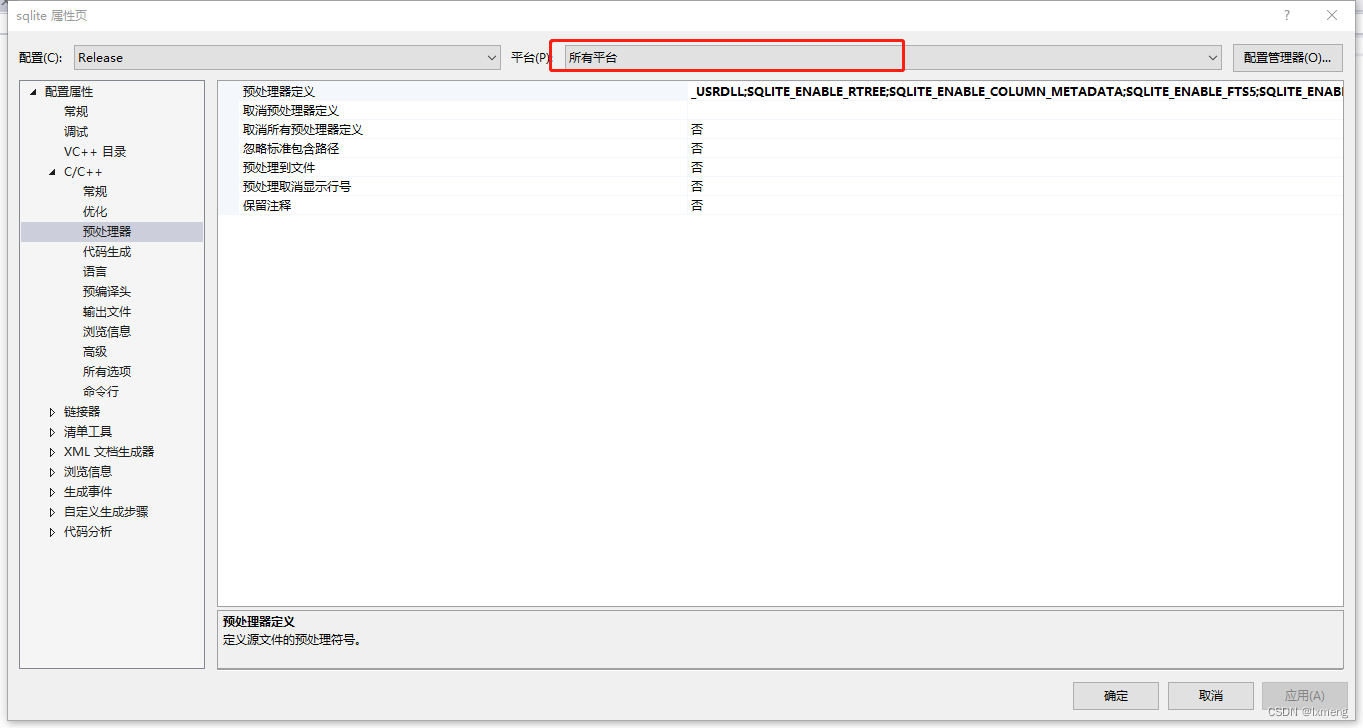
6. 修改
“配置属性”->”C/C++”->”预处理器”,右侧”预处理器定义”点击最右边的下拉后选”编辑”,在弹出的窗口中,把”<不同选项>”改为以下的值后确定。
_USRDLL
SQLITE_ENABLE_RTREE
SQLITE_ENABLE_COLUMN_METADATA
SQLITE_ENABLE_FTS5
SQLITE_ENABLE_UNLOCK_NOTIFY
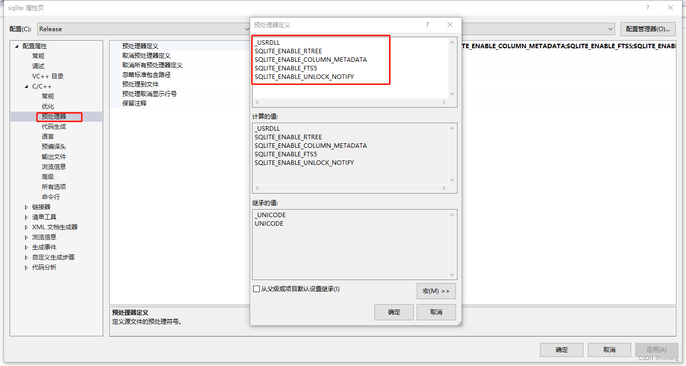
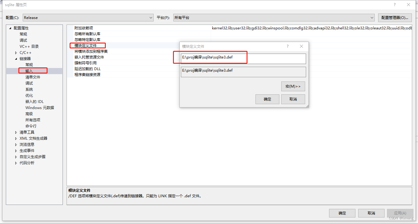
7.修改”配置属性”->”链接器”->”输入”,右侧”模块定义文件”点击最右边的下拉后选”编辑”,在弹出的窗口中,输入sqlite3.def后确定。
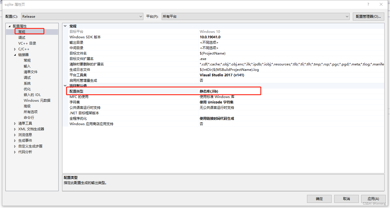
8.修改生成类型为静态库
9.编译生成文件,并
按如下形式新建三个文件夹并复制相关文件,为后面库的编译处理提供基础。
+– include — sqlite3.h
| |—— sqlite3ext.h
+– bin —— sqllite3.exe
+– lib —— sqlite.lib
-
安装cmake-gui
下载地址:
Download | CMake
双击安装即可。
-
编译libtiff
下载地址:
Index of /libtiff/
-
解压文件
-
打开cmake-gui,源码目录选择解压后的目录,并指定生成目录

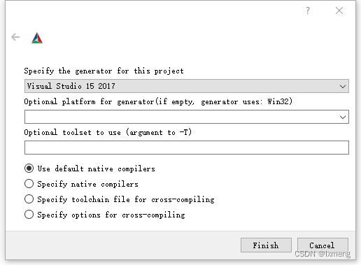
3.点击configure,选择对应的vs版本,其它选项不用修改。
4.如果上一步没有错误,点击Generate,生成VS工程文件。

5.使用管理员权限打开VS,并打开上一步生成的工程。(非管理员编译会报错)
,
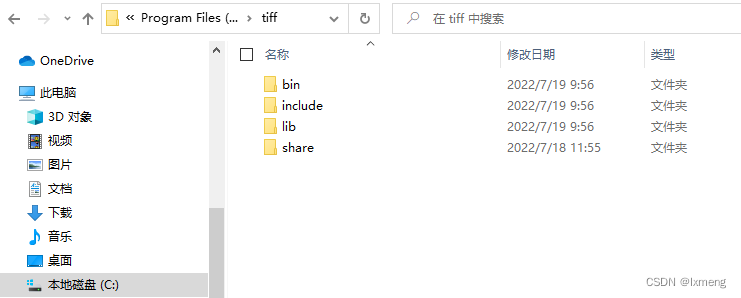
生成ALL_BUILD和INSTALL项目,它将自动生成到C盘。

-
编译proj
下载地址:
GitHub – OSGeo/PROJ: PROJ – Cartographic Projections and Coordinate Transformations Library
-
解压文件
-
代开Cmake-gui,源码目录选择解压后的目录,并指定生成目录

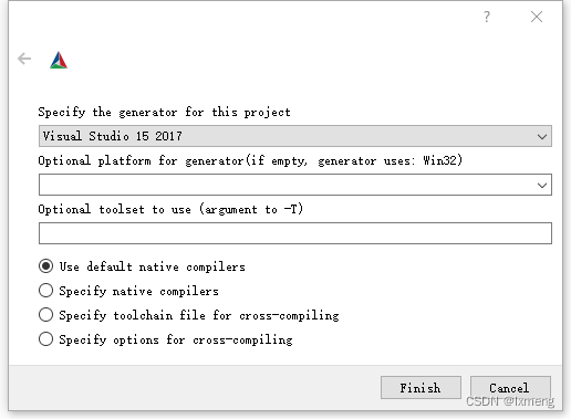
3.点击configure,选择对应的vs版本,其它选项不用修改。
4.此时会提示sqlite、tiff找不到,勾选”Grouped”和”Advanced”多选框,并手动指定路径,点击configure。

5.如果依然提示Error,说明配置有问题,查看日志发现curl找不到,再列表中
把ENABLE.ENABLE_CURL的选项去掉
,点击configure。

6.日志中提示“projsync requires Curl”,
把BUILD.BUILD_PROJSYNC选项去掉
,点击configure。


7.
如果上一步没有错误,
点击Generate按钮,生成项目文件。

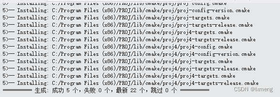
8.使用管理员权限打开vs,并打开上一步生成的工程文件。生成ALL_BUILD和INSTALL项目,它将自动生成到C盘。

-
使用proj进行坐标转换
GPS84与西安80坐标系转换示例:
QMap
<
int
,
QString
>
Xian80_3DegreeGaussKrugerZone
;
//************************************************************
//*
填充坐标类型编号
//************************************************************
void
fillXian80_3_degree_Gauss_Kruger_zone
()
{
Xian80_3DegreeGaussKrugerZone
[
25
]
=
QString
(
“EPSG:4513”
);
Xian80_3DegreeGaussKrugerZone
[
26
]
=
QString
(
“EPSG:4514”
);
Xian80_3DegreeGaussKrugerZone
[
27
]
=
QString
(
“EPSG:4515”
);
Xian80_3DegreeGaussKrugerZone
[
28
]
=
QString
(
“EPSG:4516”
);
Xian80_3DegreeGaussKrugerZone
[
29
]
=
QString
(
“EPSG:4517”
);
Xian80_3DegreeGaussKrugerZone
[
30
]
=
QString
(
“EPSG:4518”
);
Xian80_3DegreeGaussKrugerZone
[
31
]
=
QString
(
“EPSG:4519”
);
Xian80_3DegreeGaussKrugerZone
[
32
]
=
QString
(
“EPSG:4520”
);
Xian80_3DegreeGaussKrugerZone
[
33
]
=
QString
(
“EPSG:4521”
);
Xian80_3DegreeGaussKrugerZone
[
34
]
=
QString
(
“EPSG:4522”
);
Xian80_3DegreeGaussKrugerZone
[
35
]
=
QString
(
“EPSG:4523”
);
Xian80_3DegreeGaussKrugerZone
[
36
]
=
QString
(
“EPSG:4524”
);
Xian80_3DegreeGaussKrugerZone
[
37
]
=
QString
(
“EPSG:4525”
);
Xian80_3DegreeGaussKrugerZone
[
38
]
=
QString
(
“EPSG:4526”
);
Xian80_3DegreeGaussKrugerZone
[
39
]
=
QString
(
“EPSG:4527”
);
Xian80_3DegreeGaussKrugerZone
[
40
]
=
QString
(
“EPSG:4528”
);
Xian80_3DegreeGaussKrugerZone
[
41
]
=
QString
(
“EPSG:4529”
);
Xian80_3DegreeGaussKrugerZone
[
42
]
=
QString
(
“EPSG:4530”
);
Xian80_3DegreeGaussKrugerZone
[
43
]
=
QString
(
“EPSG:4531”
);
Xian80_3DegreeGaussKrugerZone
[
44
]
=
QString
(
“EPSG:4532”
);
Xian80_3DegreeGaussKrugerZone
[
45
]
=
QString
(
“EPSG:4533”
);
}
//************************************************************
//*
GPS84=>Xian80转换
//************************************************************
GPS
Gps84ToXian80
(
const
double
&
lng
,
const
double
&
lat
)
{
if
(
Xian80_3DegreeGaussKrugerZone
.
size
() ==
0
)
{
fillXian80_3_degree_Gauss_Kruger_zone
();
}
//
创建一个上下文对象
PJ_CONTEXT
*
C
=
proj_context_create
();
//
创建转换对象
int
nIndex
= (
int
)((
lng
+
1.5
) /
3
);
QMap
<
int
,
QString
>::
iterator
it
=
Xian80_3DegreeGaussKrugerZone
.
find
(
nIndex
);
if
(
it
==
Xian80_3DegreeGaussKrugerZone
.
end
())
{
qDebug
()
<<
“index
is
out
of
range.”
;
return
{
0
,
0
};
}
PJ
*
P
=
proj_create_crs_to_crs
(
C
,
“EPSG:4326”
,(
const
char
*)
it
.
value
().toUtf8(),
NULL
);
if
(
0
==
P
) {
qDebug
()
<<
“Failed
to
create
transformation
object.”
;
return
{
0
,
0
};
}
PJ
*
norm
=
proj_normalize_for_visualization
(
C
,
P
);
if
(
0
==
norm
) {
qDebug
()
<<
“Failed
to
normalize
transformation
object.\n”
;
return
{
0
,
0
};
}
proj_destroy
(
P
);
P
=
norm
;
//
初始化PJ_COORD对象
PJ_COORD
ptGPS84
=
proj_coord
(
lng
,
lat
,
0
,
0
);
PJ_COORD
ptXian80
=
proj_trans
(
P
,
PJ_FWD
,
ptGPS84
);
return
{
ptXian80
.
enu
.
e
,
ptXian80
.
enu
.
n
};
}
//************************************************************
//*
Xian80=>GPS84转换
//************************************************************
GPS
Xian80ToGps84
(
const
double
&
lng
,
const
double
&
lat
)
{
if
(
Xian80_3DegreeGaussKrugerZone
.
size
() ==
0
)
{
fillXian80_3_degree_Gauss_Kruger_zone
();
}
//
创建一个上下文对象
PJ_CONTEXT
*
C
=
proj_context_create
();
//
创建转换对象
int
nIndex
= (
int
)(
int
)(
lng
/
1000000.0
);
QMap
<
int
,
QString
>::
iterator
it
=
Xian80_3DegreeGaussKrugerZone
.
find
(
nIndex
);
if
(
it
==
Xian80_3DegreeGaussKrugerZone
.
end
())
{
qDebug
()
<<
“index
is
out
of
range.”
;
return
{
0
,
0
};
}
PJ
*
P
=
proj_create_crs_to_crs
(
C
, (
const
char
*)
it
.
value
().toUtf8(),
“EPSG:4326”
,
NULL
);
if
(
0
==
P
) {
qDebug
()
<<
“Failed
to
create
transformation
object.”
;
return
{
0
,
0
};
}
PJ
*
norm
=
proj_normalize_for_visualization
(
C
,
P
);
if
(
0
==
norm
) {
qDebug
()
<<
“Failed
to
normalize
transformation
object.\n”
;
return
{
0
,
0
};
}
proj_destroy
(
P
);
P
=
norm
;
//
初始化PJ_COORD对象
PJ_COORD
ptXian80
=
proj_coord
(
lng
,
lat
,
0
,
0
);
PJ_COORD
ptGPS84
=
proj_trans
(
P
,
PJ_FWD
,
ptXian80
);
return
{
ptGPS84
.
enu
.
e
,
ptGPS84
.
enu
.
n
};
}
常用坐标系epsg编号:
const epsg = [
{ “id”: 2348, “name” : “高斯大地坐标系_西安80_23带6_北”, “type” : 1, “strProject” : “+proj=tmerc +lat_0=0 +lon_0=135 +k=1 +x_0=500000 +y_0=0 +a=6378140 +b=6356755.288157528 +units=m +no_defs” },
{ “id”: 2347, “name” : “高斯大地坐标系_西安80_22带6_北”, “type” : 1, “strProject” : “+proj=tmerc +lat_0=0 +lon_0=129 +k=1 +x_0=500000 +y_0=0 +a=6378140 +b=6356755.288157528 +units=m +no_defs” },
{ “id”: 2346, “name” : “高斯大地坐标系_西安80_21带6_北”, “type” : 1, “strProject” : “+proj=tmerc +lat_0=0 +lon_0=123 +k=1 +x_0=500000 +y_0=0 +a=6378140 +b=6356755.288157528 +units=m +no_defs” },
{ “id”: 2345, “name” : “高斯大地坐标系_西安80_20带6_北”, “type” : 1, “strProject” : “+proj=tmerc +lat_0=0 +lon_0=117 +k=1 +x_0=500000 +y_0=0 +a=6378140 +b=6356755.288157528 +units=m +no_defs” },
{ “id”: 2344, “name” : “高斯大地坐标系_西安80_19带6_北”, “type” : 1, “strProject” : “+proj=tmerc +lat_0=0 +lon_0=111 +k=1 +x_0=500000 +y_0=0 +a=6378140 +b=6356755.288157528 +units=m +no_defs” },
{ “id”: 2343, “name” : “高斯大地坐标系_西安80_18带6_北”, “type” : 1, “strProject” : “+proj=tmerc +lat_0=0 +lon_0=105 +k=1 +x_0=500000 +y_0=0 +a=6378140 +b=6356755.288157528 +units=m +no_defs” },
{ “id”: 2342, “name” : “高斯大地坐标系_西安80_17带6_北”, “type” : 1, “strProject” : “+proj=tmerc +lat_0=0 +lon_0=99 +k=1 +x_0=500000 +y_0=0 +a=6378140 +b=6356755.288157528 +units=m +no_defs” },
{ “id”: 2341, “name” : “高斯大地坐标系_西安80_16带6_北”, “type” : 1, “strProject” : “+proj=tmerc +lat_0=0 +lon_0=93 +k=1 +x_0=500000 +y_0=0 +a=6378140 +b=6356755.288157528 +units=m +no_defs” },
{ “id”: 2340, “name” : “高斯大地坐标系_西安80_15带6_北”, “type” : 1, “strProject” : “+proj=tmerc +lat_0=0 +lon_0=87 +k=1 +x_0=500000 +y_0=0 +a=6378140 +b=6356755.288157528 +units=m +no_defs” },
{ “id”: 2339, “name” : “高斯大地坐标系_西安80_14带6_北”, “type” : 1, “strProject” : “+proj=tmerc +lat_0=0 +lon_0=75 +k=1 +x_0=500000 +y_0=0 +a=6378140 +b=6356755.288157528 +units=m +no_defs” },
{ “id”: 2338, “name” : “高斯大地坐标系_西安80_13带6_北”, “type” : 1, “strProject” : “+proj=tmerc +lat_0=0 +lon_0=75 +k=1 +x_0=500000 +y_0=0 +a=6378140 +b=6356755.288157528 +units=m +no_defs” },
{ “id”: 2390, “name” : “高斯大地坐标系_西安80_45带3_北”, “type” : 1, “strProject” : “+proj=tmerc +lat_0=0 +lon_0=135 +k=1 +x_0=500000 +y_0=0 +a=6378140 +b=6356755.288157528 +units=m +no_defs” },
{ “id”: 2389, “name” : “高斯大地坐标系_西安80_44带3_北”, “type” : 1, “strProject” : “+proj=tmerc +lat_0=0 +lon_0=132 +k=1 +x_0=500000 +y_0=0 +a=6378140 +b=6356755.288157528 +units=m +no_defs” },
{ “id”: 2388, “name” : “高斯大地坐标系_西安80_43带3_北”, “type” : 1, “strProject” : “+proj=tmerc +lat_0=0 +lon_0=129 +k=1 +x_0=500000 +y_0=0 +a=6378140 +b=6356755.288157528 +units=m +no_defs” },
{ “id”: 2387, “name” : “高斯大地坐标系_西安80_42带3_北”, “type” : 1, “strProject” : “+proj=tmerc +lat_0=0 +lon_0=126 +k=1 +x_0=500000 +y_0=0 +a=6378140 +b=6356755.288157528 +units=m +no_defs” },
{ “id”: 2386, “name” : “高斯大地坐标系_西安80_41带3_北”, “type” : 1, “strProject” : “+proj=tmerc +lat_0=0 +lon_0=123 +k=1 +x_0=500000 +y_0=0 +a=6378140 +b=6356755.288157528 +units=m +no_defs” },
{ “id”: 2385, “name” : “高斯大地坐标系_西安80_40带3_北”, “type” : 1, “strProject” : “+proj=tmerc +lat_0=0 +lon_0=120 +k=1 +x_0=500000 +y_0=0 +a=6378140 +b=6356755.288157528 +units=m +no_defs” },
{ “id”: 2384, “name” : “高斯大地坐标系_西安80_39带3_北”, “type” : 1, “strProject” : “+proj=tmerc +lat_0=0 +lon_0=117 +k=1 +x_0=500000 +y_0=0 +a=6378140 +b=6356755.288157528 +units=m +no_defs” },
{ “id”: 2383, “name” : “高斯大地坐标系_西安80_38带3_北”, “type” : 1, “strProject” : “+proj=tmerc +lat_0=0 +lon_0=114 +k=1 +x_0=500000 +y_0=0 +a=6378140 +b=6356755.288157528 +units=m +no_defs” },
{ “id”: 2382, “name” : “高斯大地坐标系_西安80_37带3_北”, “type” : 1, “strProject” : “+proj=tmerc +lat_0=0 +lon_0=111 +k=1 +x_0=500000 +y_0=0 +a=6378140 +b=6356755.288157528 +units=m +no_defs” },
{ “id”: 2381, “name” : “高斯大地坐标系_西安80_36带3_北”, “type” : 1, “strProject” : “+proj=tmerc +lat_0=0 +lon_0=108 +k=1 +x_0=500000 +y_0=0 +a=6378140 +b=6356755.288157528 +units=m +no_defs” },
{ “id”: 2380, “name” : “高斯大地坐标系_西安80_35带3_北”, “type” : 1, “strProject” : “+proj=tmerc +lat_0=0 +lon_0=105 +k=1 +x_0=500000 +y_0=0 +a=6378140 +b=6356755.288157528 +units=m +no_defs” },
{ “id”: 2379, “name” : “高斯大地坐标系_西安80_34带3_北”, “type” : 1, “strProject” : “+proj=tmerc +lat_0=0 +lon_0=102 +k=1 +x_0=500000 +y_0=0 +a=6378140 +b=6356755.288157528 +units=m +no_defs” },
{ “id”: 2378, “name” : “高斯大地坐标系_西安80_33带3_北”, “type” : 1, “strProject” : “+proj=tmerc +lat_0=0 +lon_0=99 +k=1 +x_0=500000 +y_0=0 +a=6378140 +b=6356755.288157528 +units=m +no_defs” },
{ “id”: 2377, “name” : “高斯大地坐标系_西安80_32带3_北”, “type” : 1, “strProject” : “+proj=tmerc +lat_0=0 +lon_0=96 +k=1 +x_0=500000 +y_0=0 +a=6378140 +b=6356755.288157528 +units=m +no_defs” },
{ “id”: 2376, “name” : “高斯大地坐标系_西安80_31带3_北”, “type” : 1, “strProject” : “+proj=tmerc +lat_0=0 +lon_0=93 +k=1 +x_0=500000 +y_0=0 +a=6378140 +b=6356755.288157528 +units=m +no_defs” },
{ “id”: 2375, “name” : “高斯大地坐标系_西安80_30带3_北”, “type” : 1, “strProject” : “+proj=tmerc +lat_0=0 +lon_0=90 +k=1 +x_0=500000 +y_0=0 +a=6378140 +b=6356755.288157528 +units=m +no_defs” },
{ “id”: 2374, “name” : “高斯大地坐标系_西安80_29带3_北”, “type” : 1, “strProject” : “+proj=tmerc +lat_0=0 +lon_0=87 +k=1 +x_0=500000 +y_0=0 +a=6378140 +b=6356755.288157528 +units=m +no_defs” },
{ “id”: 2373, “name” : “高斯大地坐标系_西安80_28带3_北”, “type” : 1, “strProject” : “+proj=tmerc +lat_0=0 +lon_0=84 +k=1 +x_0=500000 +y_0=0 +a=6378140 +b=6356755.288157528 +units=m +no_defs” },
{ “id”: 2372, “name” : “高斯大地坐标系_西安80_27带3_北”, “type” : 1, “strProject” : “+proj=tmerc +lat_0=0 +lon_0=81 +k=1 +x_0=500000 +y_0=0 +a=6378140 +b=6356755.288157528 +units=m +no_defs” },
{ “id”: 2371, “name” : “高斯大地坐标系_西安80_26带3_北”, “type” : 1, “strProject” : “+proj=tmerc +lat_0=0 +lon_0=78 +k=1 +x_0=500000 +y_0=0 +a=6378140 +b=6356755.288157528 +units=m +no_defs” },
{ “id”: 2370, “name” : “高斯大地坐标系_西安80_25带3_北”, “type” : 1, “strProject” : “+proj=tmerc +lat_0=0 +lon_0=75 +k=1 +x_0=500000 +y_0=0 +a=6378140 +b=6356755.288157528 +units=m +no_defs” },
{ “id”: 2327, “name” : “高斯大地坐标系_西安80_13带6_北2”, “type” : 0, “strProject” : “+proj=tmerc +lat_0=0 +lon_0=75 +k=1 +x_0=13500000 +y_0=0 +a=6378140 +b=6356755.288157528 +units=m +no_defs” },
{ “id”: 2328, “name” : “高斯大地坐标系_西安80_14带6_北2”, “type” : 0, “strProject” : “+proj=tmerc +lat_0=0 +lon_0=81 +k=1 +x_0=14500000 +y_0=0 +a=6378140 +b=6356755.288157528 +units=m +no_defs” },
{ “id”: 2329, “name” : “高斯大地坐标系_西安80_15带6_北2”, “type” : 0, “strProject” : “+proj=tmerc +lat_0=0 +lon_0=87 +k=1 +x_0=15500000 +y_0=0 +a=6378140 +b=6356755.288157528 +units=m +no_defs” },
{ “id”: 2330, “name” : “高斯大地坐标系_西安80_16带6_北2”, “type” : 0, “strProject” : “+proj=tmerc +lat_0=0 +lon_0=93 +k=1 +x_0=16500000 +y_0=0 +a=6378140 +b=6356755.288157528 +units=m +no_defs” },
{ “id”: 2331, “name” : “高斯大地坐标系_西安80_17带6_北2”, “type” : 0, “strProject” : “+proj=tmerc +lat_0=0 +lon_0=99 +k=1 +x_0=17500000 +y_0=0 +a=6378140 +b=6356755.288157528 +units=m +no_defs” },
{ “id”: 2332, “name” : “高斯大地坐标系_西安80_18带6_北2”, “type” : 0, “strProject” : “+proj=tmerc +lat_0=0 +lon_0=105 +k=1 +x_0=18500000 +y_0=0 +a=6378140 +b=6356755.288157528 +units=m +no_defs” },
{ “id”: 2333, “name” : “高斯大地坐标系_西安80_19带6_北2”, “type” : 0, “strProject” : “+proj=tmerc +lat_0=0 +lon_0=111 +k=1 +x_0=19500000 +y_0=0 +a=6378140 +b=6356755.288157528 +units=m +no_defs” },
{ “id”: 2334, “name” : “高斯大地坐标系_西安80_20带6_北2”, “type” : 0, “strProject” : “+proj=tmerc +lat_0=0 +lon_0=117 +k=1 +x_0=20500000 +y_0=0 +a=6378140 +b=6356755.288157528 +units=m +no_defs” },
{ “id”: 2335, “name” : “高斯大地坐标系_西安80_21带6_北2”, “type” : 0, “strProject” : “+proj=tmerc +lat_0=0 +lon_0=123 +k=1 +x_0=21500000 +y_0=0 +a=6378140 +b=6356755.288157528 +units=m +no_defs” },
{ “id”: 2336, “name” : “高斯大地坐标系_西安80_22带6_北2”, “type” : 0, “strProject” : “+proj=tmerc +lat_0=0 +lon_0=129 +k=1 +x_0=22500000 +y_0=0 +a=6378140 +b=6356755.288157528 +units=m +no_defs” },
{ “id”: 2337, “name” : “高斯大地坐标系_西安80_23带6_北2”, “type” : 0, “strProject” : “+proj=tmerc +lat_0=0 +lon_0=135 +k=1 +x_0=23500000 +y_0=0 +a=6378140 +b=6356755.288157528 +units=m +no_defs” },
{ “id”: 2403, “name” : “高斯大地坐标系_西安80_27带6_北2”, “type” : 0, “strProject” : “+proj=tmerc +lat_0=0 +lon_0=81 +k=1 +x_0=27500000 +y_0=0 +ellps=krass +towgs84=15.8,-154.4,-82.3,0,0,0,0 +units=m +no_defs” },
{ “id”: 2404, “name” : “高斯大地坐标系_西安80_28带6_北2”, “type” : 0, “strProject” : “+proj=tmerc +lat_0=0 +lon_0=84 +k=1 +x_0=28500000 +y_0=0 +ellps=krass +towgs84=15.8,-154.4,-82.3,0,0,0,0 +units=m +no_defs” },
{ “id”: 2405, “name” : “高斯大地坐标系_西安80_29带6_北2”, “type” : 0, “strProject” : “+proj=tmerc +lat_0=0 +lon_0=87 +k=1 +x_0=29500000 +y_0=0 +ellps=krass +towgs84=15.8,-154.4,-82.3,0,0,0,0 +units=m +no_defs” },
{ “id”: 2406, “name” : “高斯大地坐标系_西安80_30带6_北2”, “type” : 0, “strProject” : “+proj=tmerc +lat_0=0 +lon_0=90 +k=1 +x_0=30500000 +y_0=0 +ellps=krass +towgs84=15.8,-154.4,-82.3,0,0,0,0 +units=m +no_defs” },
{ “id”: 2407, “name” : “高斯大地坐标系_西安80_31带6_北2”, “type” : 0, “strProject” : “+proj=tmerc +lat_0=0 +lon_0=93 +k=1 +x_0=31500000 +y_0=0 +ellps=krass +towgs84=15.8,-154.4,-82.3,0,0,0,0 +units=m +no_defs” },
{ “id”: 2408, “name” : “高斯大地坐标系_西安80_32带6_北2”, “type” : 0, “strProject” : “+proj=tmerc +lat_0=0 +lon_0=96 +k=1 +x_0=32500000 +y_0=0 +ellps=krass +towgs84=15.8,-154.4,-82.3,0,0,0,0 +units=m +no_defs” },
{ “id”: 2409, “name” : “高斯大地坐标系_西安80_33带6_北2”, “type” : 0, “strProject” : “+proj=tmerc +lat_0=0 +lon_0=99 +k=1 +x_0=33500000 +y_0=0 +ellps=krass +towgs84=15.8,-154.4,-82.3,0,0,0,0 +units=m +no_defs” },
{ “id”: 2410, “name” : “高斯大地坐标系_西安80_34带6_北2”, “type” : 0, “strProject” : “+proj=tmerc +lat_0=0 +lon_0=102 +k=1 +x_0=34500000 +y_0=0 +ellps=krass +towgs84=15.8,-154.4,-82.3,0,0,0,0 +units=m +no_defs” },
{ “id”: 2411, “name” : “高斯大地坐标系_西安80_35带6_北2”, “type” : 0, “strProject” : “+proj=tmerc +lat_0=0 +lon_0=105 +k=1 +x_0=35500000 +y_0=0 +ellps=krass +towgs84=15.8,-154.4,-82.3,0,0,0,0 +units=m +no_defs” },
{ “id”: 2412, “name” : “高斯大地坐标系_西安80_36带6_北2”, “type” : 0, “strProject” : “+proj=tmerc +lat_0=0 +lon_0=108 +k=1 +x_0=36500000 +y_0=0 +ellps=krass +towgs84=15.8,-154.4,-82.3,0,0,0,0 +units=m +no_defs” },
{ “id”: 2413, “name” : “高斯大地坐标系_西安80_37带6_北2”, “type” : 0, “strProject” : “+proj=tmerc +lat_0=0 +lon_0=111 +k=1 +x_0=37500000 +y_0=0 +ellps=krass +towgs84=15.8,-154.4,-82.3,0,0,0,0 +units=m +no_defs” },
{ “id”: 2414, “name” : “高斯大地坐标系_西安80_38带6_北2”, “type” : 0, “strProject” : “+proj=tmerc +lat_0=0 +lon_0=114 +k=1 +x_0=38500000 +y_0=0 +ellps=krass +towgs84=15.8,-154.4,-82.3,0,0,0,0 +units=m +no_defs” },
{ “id”: 2415, “name” : “高斯大地坐标系_西安80_39带6_北2”, “type” : 0, “strProject” : “+proj=tmerc +lat_0=0 +lon_0=117 +k=1 +x_0=39500000 +y_0=0 +ellps=krass +towgs84=15.8,-154.4,-82.3,0,0,0,0 +units=m +no_defs” },
{ “id”: 2416, “name” : “高斯大地坐标系_西安80_40带6_北2”, “type” : 0, “strProject” : “+proj=tmerc +lat_0=0 +lon_0=120 +k=1 +x_0=40500000 +y_0=0 +ellps=krass +towgs84=15.8,-154.4,-82.3,0,0,0,0 +units=m +no_defs” },
{ “id”: 2417, “name” : “高斯大地坐标系_西安80_41带6_北2”, “type” : 0, “strProject” : “+proj=tmerc +lat_0=0 +lon_0=123 +k=1 +x_0=41500000 +y_0=0 +ellps=krass +towgs84=15.8,-154.4,-82.3,0,0,0,0 +units=m +no_defs” },
{ “id”: 2418, “name” : “高斯大地坐标系_西安80_42带6_北2”, “type” : 0, “strProject” : “+proj=tmerc +lat_0=0 +lon_0=126 +k=1 +x_0=42500000 +y_0=0 +ellps=krass +towgs84=15.8,-154.4,-82.3,0,0,0,0 +units=m +no_defs” },
{ “id”: 2419, “name” : “高斯大地坐标系_西安80_43带6_北2”, “type” : 0, “strProject” : “+proj=tmerc +lat_0=0 +lon_0=129 +k=1 +x_0=43500000 +y_0=0 +ellps=krass +towgs84=15.8,-154.4,-82.3,0,0,0,0 +units=m +no_defs” },
{ “id”: 2420, “name” : “高斯大地坐标系_西安80_44带6_北2”, “type” : 0, “strProject” : “+proj=tmerc +lat_0=0 +lon_0=132 +k=1 +x_0=44500000 +y_0=0 +ellps=krass +towgs84=15.8,-154.4,-82.3,0,0,0,0 +units=m +no_defs” },
{ “id”: 2421, “name” : “高斯大地坐标系_西安80_45带6_北2”, “type” : 0, “strProject” : “+proj=tmerc +lat_0=0 +lon_0=135 +k=1 +x_0=45500000 +y_0=0 +ellps=krass +towgs84=15.8,-154.4,-82.3,0,0,0,0 +units=m +no_defs” },
{ “id”: 2349, “name” : “高斯大地坐标系_西安80_25带3_北2”, “type” : 0, “strProject” : “+proj=tmerc +lat_0=0 +lon_0=75 +k=1 +x_0=25500000 +y_0=0 +a=6378140 +b=6356755.288157528 +units=m +no_defs” },
{ “id”: 2350, “name” : “高斯大地坐标系_西安80_26带3_北2”, “type” : 0, “strProject” : “+proj=tmerc +lat_0=0 +lon_0=78 +k=1 +x_0=26500000 +y_0=0 +a=6378140 +b=6356755.288157528 +units=m +no_defs” },
{ “id”: 2351, “name” : “高斯大地坐标系_西安80_27带3_北2”, “type” : 0, “strProject” : “+proj=tmerc +lat_0=0 +lon_0=81 +k=1 +x_0=27500000 +y_0=0 +a=6378140 +b=6356755.288157528 +units=m +no_defs” },
{ “id”: 2352, “name” : “高斯大地坐标系_西安80_28带3_北2”, “type” : 0, “strProject” : “+proj=tmerc +lat_0=0 +lon_0=84 +k=1 +x_0=28500000 +y_0=0 +a=6378140 +b=6356755.288157528 +units=m +no_defs” },
{ “id”: 2353, “name” : “高斯大地坐标系_西安80_29带3_北2”, “type” : 0, “strProject” : “+proj=tmerc +lat_0=0 +lon_0=87 +k=1 +x_0=29500000 +y_0=0 +a=6378140 +b=6356755.288157528 +units=m +no_defs” },
{ “id”: 2354, “name” : “高斯大地坐标系_西安80_30带3_北2”, “type” : 0, “strProject” : “+proj=tmerc +lat_0=0 +lon_0=90 +k=1 +x_0=30500000 +y_0=0 +a=6378140 +b=6356755.288157528 +units=m +no_defs” },
{ “id”: 2355, “name” : “高斯大地坐标系_西安80_31带3_北2”, “type” : 0, “strProject” : “+proj=tmerc +lat_0=0 +lon_0=93 +k=1 +x_0=31500000 +y_0=0 +a=6378140 +b=6356755.288157528 +units=m +no_defs” },
{ “id”: 2356, “name” : “高斯大地坐标系_西安80_32带3_北2”, “type” : 0, “strProject” : “+proj=tmerc +lat_0=0 +lon_0=96 +k=1 +x_0=32500000 +y_0=0 +a=6378140 +b=6356755.288157528 +units=m +no_defs” },
{ “id”: 2357, “name” : “高斯大地坐标系_西安80_33带3_北2”, “type” : 0, “strProject” : “+proj=tmerc +lat_0=0 +lon_0=99 +k=1 +x_0=33500000 +y_0=0 +a=6378140 +b=6356755.288157528 +units=m +no_defs” },
{ “id”: 2358, “name” : “高斯大地坐标系_西安80_34带3_北2”, “type” : 0, “strProject” : “+proj=tmerc +lat_0=0 +lon_0=102 +k=1 +x_0=34500000 +y_0=0 +a=6378140 +b=6356755.288157528 +units=m +no_defs” },
{ “id”: 2359, “name” : “高斯大地坐标系_西安80_35带3_北2”, “type” : 0, “strProject” : “+proj=tmerc +lat_0=0 +lon_0=105 +k=1 +x_0=35500000 +y_0=0 +a=6378140 +b=6356755.288157528 +units=m +no_defs” },
{ “id”: 2360, “name” : “高斯大地坐标系_西安80_36带3_北2”, “type” : 0, “strProject” : “+proj=tmerc +lat_0=0 +lon_0=108 +k=1 +x_0=36500000 +y_0=0 +a=6378140 +b=6356755.288157528 +units=m +no_defs” },
{ “id”: 2361, “name” : “高斯大地坐标系_西安80_37带3_北2”, “type” : 0, “strProject” : “+proj=tmerc +lat_0=0 +lon_0=111 +k=1 +x_0=37500000 +y_0=0 +a=6378140 +b=6356755.288157528 +units=m +no_defs” },
{ “id”: 2362, “name” : “高斯大地坐标系_西安80_38带3_北2”, “type” : 0, “strProject” : “+proj=tmerc +lat_0=0 +lon_0=114 +k=1 +x_0=38500000 +y_0=0 +a=6378140 +b=6356755.288157528 +units=m +no_defs” },
{ “id”: 2363, “name” : “高斯大地坐标系_西安80_39带3_北2”, “type” : 0, “strProject” : “+proj=tmerc +lat_0=0 +lon_0=117 +k=1 +x_0=39500000 +y_0=0 +a=6378140 +b=6356755.288157528 +units=m +no_defs” },
{ “id”: 2364, “name” : “高斯大地坐标系_西安80_40带3_北2”, “type” : 0, “strProject” : “+proj=tmerc +lat_0=0 +lon_0=120 +k=1 +x_0=40500000 +y_0=0 +a=6378140 +b=6356755.288157528 +units=m +no_defs” },
{ “id”: 2365, “name” : “高斯大地坐标系_西安80_41带3_北2”, “type” : 0, “strProject” : “+proj=tmerc +lat_0=0 +lon_0=123 +k=1 +x_0=41500000 +y_0=0 +a=6378140 +b=6356755.288157528 +units=m +no_defs” },
{ “id”: 2366, “name” : “高斯大地坐标系_西安80_42带3_北2”, “type” : 0, “strProject” : “+proj=tmerc +lat_0=0 +lon_0=126 +k=1 +x_0=42500000 +y_0=0 +a=6378140 +b=6356755.288157528 +units=m +no_defs” },
{ “id”: 2367, “name” : “高斯大地坐标系_西安80_43带3_北2”, “type” : 0, “strProject” : “+proj=tmerc +lat_0=0 +lon_0=129 +k=1 +x_0=43500000 +y_0=0 +a=6378140 +b=6356755.288157528 +units=m +no_defs” },
{ “id”: 2368, “name” : “高斯大地坐标系_西安80_44带3_北2”, “type” : 0, “strProject” : “+proj=tmerc +lat_0=0 +lon_0=132 +k=1 +x_0=44500000 +y_0=0 +a=6378140 +b=6356755.288157528 +units=m +no_defs” },
{ “id”: 2369, “name” : “高斯大地坐标系_西安80_45带3_北2”, “type” : 0, “strProject” : “+proj=tmerc +lat_0=0 +lon_0=135 +k=1 +x_0=45500000 +y_0=0 +a=6378140 +b=6356755.288157528 +units=m +no_defs” },
{ “id”: 21413, “name” : “高斯大地坐标系_北京54_13带6_北2”, “type” : 0, “strProject” : “+proj=tmerc +lat_0=0 +lon_0=75 +k=1 +x_0=13500000 +y_0=0 +ellps=krass +towgs84=15.8,-154.4,-82.3,0,0,0,0 +units=m +no_defs” },
{ “id”: 21414, “name” : “高斯大地坐标系_北京54_14带6_北2”, “type” : 0, “strProject” : “+proj=tmerc +lat_0=0 +lon_0=81 +k=1 +x_0=14500000 +y_0=0 +ellps=krass +towgs84=15.8,-154.4,-82.3,0,0,0,0 +units=m +no_defs” },
{ “id”: 21415, “name” : “高斯大地坐标系_北京54_15带6_北2”, “type” : 0, “strProject” : “+proj=tmerc +lat_0=0 +lon_0=87 +k=1 +x_0=15500000 +y_0=0 +ellps=krass +towgs84=15.8,-154.4,-82.3,0,0,0,0 +units=m +no_defs” },
{ “id”: 21416, “name” : “高斯大地坐标系_北京54_16带6_北2”, “type” : 0, “strProject” : “+proj=tmerc +lat_0=0 +lon_0=93 +k=1 +x_0=16500000 +y_0=0 +ellps=krass +towgs84=15.8,-154.4,-82.3,0,0,0,0 +units=m +no_defs” },
{ “id”: 21417, “name” : “高斯大地坐标系_北京54_17带6_北2”, “type” : 0, “strProject” : “+proj=tmerc +lat_0=0 +lon_0=99 +k=1 +x_0=17500000 +y_0=0 +ellps=krass +towgs84=15.8,-154.4,-82.3,0,0,0,0 +units=m +no_defs” },
{ “id”: 21418, “name” : “高斯大地坐标系_北京54_18带6_北2”, “type” : 0, “strProject” : “+proj=tmerc +lat_0=0 +lon_0=105 +k=1 +x_0=18500000 +y_0=0 +ellps=krass +towgs84=15.8,-154.4,-82.3,0,0,0,0 +units=m +no_defs” },
{ “id”: 21419, “name” : “高斯大地坐标系_北京54_19带6_北2”, “type” : 0, “strProject” : “+proj=tmerc +lat_0=0 +lon_0=111 +k=1 +x_0=19500000 +y_0=0 +ellps=krass +towgs84=15.8,-154.4,-82.3,0,0,0,0 +units=m +no_defs” },
{ “id”: 21420, “name” : “高斯大地坐标系_北京54_20带6_北2”, “type” : 0, “strProject” : “+proj=tmerc +lat_0=0 +lon_0=117 +k=1 +x_0=20500000 +y_0=0 +ellps=krass +towgs84=15.8,-154.4,-82.3,0,0,0,0 +units=m +no_defs” },
{ “id”: 21421, “name” : “高斯大地坐标系_北京54_21带6_北2”, “type” : 0, “strProject” : “+proj=tmerc +lat_0=0 +lon_0=123 +k=1 +x_0=21500000 +y_0=0 +ellps=krass +towgs84=15.8,-154.4,-82.3,0,0,0,0 +units=m +no_defs” },
{ “id”: 21422, “name” : “高斯大地坐标系_北京54_22带6_北2”, “type” : 0, “strProject” : “+proj=tmerc +lat_0=0 +lon_0=129 +k=1 +x_0=22500000 +y_0=0 +ellps=krass +towgs84=15.8,-154.4,-82.3,0,0,0,0 +units=m +no_defs” },
{ “id”: 21423, “name” : “高斯大地坐标系_北京54_23带6_北2”, “type” : 0, “strProject” : “+proj=tmerc +lat_0=0 +lon_0=135 +k=1 +x_0=23500000 +y_0=0 +ellps=krass +towgs84=15.8,-154.4,-82.3,0,0,0,0 +units=m +no_defs” },
{ “id”: 2431, “name” : “高斯大地坐标系_北京54_34带3_北”, “type” : 1, “strProject” : “+proj=tmerc +lat_0=0 +lon_0=102 +k=1 +x_0=500000 +y_0=0 +ellps=krass +towgs84=15.8,-154.4,-82.3,0,0,0,0 +units=m +no_defs” },
{ “id”: 2401, “name” : “高斯大地坐标系_北京54_25带3_北2”, “type” : 0, “strProject” : “+proj=tmerc +lat_0=0 +lon_0=75 +k=1 +x_0=25500000 +y_0=0 +ellps=krass +towgs84=15.8,-154.4,-82.3,0,0,0,0 +units=m +no_defs” },
{ “id”: 2402, “name” : “高斯大地坐标系_北京54_26带3_北2”, “type” : 0, “strProject” : “+proj=tmerc +lat_0=0 +lon_0=78 +k=1 +x_0=26500000 +y_0=0 +ellps=krass +towgs84=15.8,-154.4,-82.3,0,0,0,0 +units=m +no_defs” },
{ “id”: 32646, “name” : “Beijing 1954 / 3-degree Gauss-Kruger CM 102E”, “type” : 1, “strProject” : “+proj=utm +zone=46 +datum=WGS84 +units=m +no_defs” },
{ “id”: 4502, “name” : “高斯大地坐标系_中国2000_13带6_北”, “type” : 0, “strProject” : “+proj=tmerc +lat_0=0 +lon_0=75 +k=1 +x_0=500000 +y_0=0 +ellps=GRS80 +units=m +no_defs” },
{ “id”: 4503, “name” : “高斯大地坐标系_中国2000_14带6_北”, “type” : 0, “strProject” : “+proj=tmerc +lat_0=0 +lon_0=81 +k=1 +x_0=500000 +y_0=0 +ellps=GRS80 +units=m +no_defs” },
{ “id”: 4504, “name” : “高斯大地坐标系_中国2000_15带6_北”, “type” : 0, “strProject” : “+proj=tmerc +lat_0=0 +lon_0=87 +k=1 +x_0=500000 +y_0=0 +ellps=GRS80 +units=m +no_defs” },
{ “id”: 4505, “name” : “高斯大地坐标系_中国2000_16带6_北”, “type” : 0, “strProject” : “+proj=tmerc +lat_0=0 +lon_0=93 +k=1 +x_0=500000 +y_0=0 +ellps=GRS80 +units=m +no_defs” },
{ “id”: 4506, “name” : “高斯大地坐标系_中国2000_17带6_北”, “type” : 0, “strProject” : “+proj=tmerc +lat_0=0 +lon_0=99 +k=1 +x_0=500000 +y_0=0 +ellps=GRS80 +units=m +no_defs” },
{ “id”: 4507, “name” : “高斯大地坐标系_中国2000_18带6_北”, “type” : 0, “strProject” : “+proj=tmerc +lat_0=0 +lon_0=105 +k=1 +x_0=500000 +y_0=0 +ellps=GRS80 +units=m +no_defs” },
{ “id”: 4508, “name” : “高斯大地坐标系_中国2000_19带6_北”, “type” : 0, “strProject” : “+proj=tmerc +lat_0=0 +lon_0=111 +k=1 +x_0=500000 +y_0=0 +ellps=GRS80 +units=m +no_defs” },
{ “id”: 4509, “name” : “高斯大地坐标系_中国2000_20带6_北”, “type” : 0, “strProject” : “+proj=tmerc +lat_0=0 +lon_0=117 +k=1 +x_0=500000 +y_0=0 +ellps=GRS80 +units=m +no_defs” },
{ “id”: 4510, “name” : “高斯大地坐标系_中国2000_21带6_北”, “type” : 0, “strProject” : “+proj=tmerc +lat_0=0 +lon_0=123 +k=1 +x_0=500000 +y_0=0 +ellps=GRS80 +units=m +no_defs” },
{ “id”: 4511, “name” : “高斯大地坐标系_中国2000_22带6_北”, “type” : 0, “strProject” : “+proj=tmerc +lat_0=0 +lon_0=129 +k=1 +x_0=500000 +y_0=0 +ellps=GRS80 +units=m +no_defs” },
{ “id”: 4512, “name” : “高斯大地坐标系_中国2000_23带6_北”, “type” : 0, “strProject” : “+proj=tmerc +lat_0=0 +lon_0=135 +k=1 +x_0=500000 +y_0=0 +ellps=GRS80 +units=m +no_defs” },
{ “id”: 4513, “name” : “高斯大地坐标系_中国2000_25带6_北”, “type” : 0, “strProject” : “+proj=tmerc +lat_0=0 +lon_0=75 +k=1 +x_0=25500000 +y_0=0 +ellps=GRS80 +units=m +no_defs” },
{ “id”: 4514, “name” : “高斯大地坐标系_中国2000_26带6_北”, “type” : 0, “strProject” : “+proj=tmerc +lat_0=0 +lon_0=78 +k=1 +x_0=26500000 +y_0=0 +ellps=GRS80 +units=m +no_defs” },
{ “id”: 4515, “name” : “高斯大地坐标系_中国2000_27带3_北2”, “type” : 0, “strProject” : “+proj=tmerc +lat_0=0 +lon_0=81 +k=1 +x_0=27500000 +y_0=0 +ellps=GRS80 +units=m +no_defs” },
{ “id”: 4516, “name” : “高斯大地坐标系_中国2000_28带3_北2”, “type” : 0, “strProject” : “+proj=tmerc +lat_0=0 +lon_0=84 +k=1 +x_0=28500000 +y_0=0 +ellps=GRS80 +units=m +no_defs” },
{ “id”: 4517, “name” : “高斯大地坐标系_中国2000_29带3_北2”, “type” : 0, “strProject” : “+proj=tmerc +lat_0=0 +lon_0=87 +k=1 +x_0=29500000 +y_0=0 +ellps=GRS80 +units=m +no_defs” },
{ “id”: 4518, “name” : “高斯大地坐标系_中国2000_30带3_北2”, “type” : 0, “strProject” : “+proj=tmerc +lat_0=0 +lon_0=90 +k=1 +x_0=30500000 +y_0=0 +ellps=GRS80 +units=m +no_defs” },
{ “id”: 4519, “name” : “高斯大地坐标系_中国2000_31带3_北2”, “type” : 0, “strProject” : “+proj=tmerc +lat_0=0 +lon_0=93 +k=1 +x_0=31500000 +y_0=0 +ellps=GRS80 +units=m +no_defs” },
{ “id”: 4520, “name” : “高斯大地坐标系_中国2000_32带3_北2”, “type” : 0, “strProject” : “+proj=tmerc +lat_0=0 +lon_0=96 +k=1 +x_0=32500000 +y_0=0 +ellps=GRS80 +units=m +no_defs” },
{ “id”: 4521, “name” : “高斯大地坐标系_中国2000_33带3_北2”, “type” : 0, “strProject” : “+proj=tmerc +lat_0=0 +lon_0=99 +k=1 +x_0=33500000 +y_0=0 +ellps=GRS80 +units=m +no_defs” },
{ “id”: 4522, “name” : “高斯大地坐标系_中国2000_34带3_北2”, “type” : 0, “strProject” : “+proj=tmerc +lat_0=0 +lon_0=102 +k=1 +x_0=34500000 +y_0=0 +ellps=GRS80 +units=m +no_defs” },
{ “id”: 4523, “name” : “高斯大地坐标系_中国2000_35带3_北2”, “type” : 0, “strProject” : “+proj=tmerc +lat_0=0 +lon_0=105 +k=1 +x_0=35500000 +y_0=0 +ellps=GRS80 +units=m +no_defs” },
{ “id”: 4524, “name” : “高斯大地坐标系_中国2000_36带3_北2”, “type” : 0, “strProject” : “+proj=tmerc +lat_0=0 +lon_0=108 +k=1 +x_0=36500000 +y_0=0 +ellps=GRS80 +units=m +no_defs” },
{ “id”: 4525, “name” : “高斯大地坐标系_中国2000_37带3_北2”, “type” : 0, “strProject” : “+proj=tmerc +lat_0=0 +lon_0=111 +k=1 +x_0=37500000 +y_0=0 +ellps=GRS80 +units=m +no_defs” },
{ “id”: 4526, “name” : “高斯大地坐标系_中国2000_38带3_北2”, “type” : 0, “strProject” : “+proj=tmerc +lat_0=0 +lon_0=114 +k=1 +x_0=38500000 +y_0=0 +ellps=GRS80 +units=m +no_defs” },
{ “id”: 4527, “name” : “高斯大地坐标系_中国2000_39带3_北2”, “type” : 0, “strProject” : “+proj=tmerc +lat_0=0 +lon_0=117 +k=1 +x_0=39500000 +y_0=0 +ellps=GRS80 +units=m +no_defs” },
{ “id”: 4528, “name” : “高斯大地坐标系_中国2000_40带3_北2”, “type” : 0, “strProject” : “+proj=tmerc +lat_0=0 +lon_0=120 +k=1 +x_0=40500000 +y_0=0 +ellps=GRS80 +units=m +no_defs” },
{ “id”: 4529, “name” : “高斯大地坐标系_中国2000_41带3_北2”, “type” : 0, “strProject” : “+proj=tmerc +lat_0=0 +lon_0=123 +k=1 +x_0=41500000 +y_0=0 +ellps=GRS80 +units=m +no_defs” },
{ “id”: 4530, “name” : “高斯大地坐标系_中国2000_42带3_北2”, “type” : 0, “strProject” : “+proj=tmerc +lat_0=0 +lon_0=126 +k=1 +x_0=42500000 +y_0=0 +ellps=GRS80 +units=m +no_defs” },
{ “id”: 4531, “name” : “高斯大地坐标系_中国2000_43带3_北2”, “type” : 0, “strProject” : “+proj=tmerc +lat_0=0 +lon_0=129 +k=1 +x_0=43500000 +y_0=0 +ellps=GRS80 +units=m +no_defs” },
{ “id”: 4532, “name” : “高斯大地坐标系_中国2000_44带3_北2”, “type” : 0, “strProject” : “+proj=tmerc +lat_0=0 +lon_0=132 +k=1 +x_0=44500000 +y_0=0 +ellps=GRS80 +units=m +no_defs” },
{ “id”: 4533, “name” : “高斯大地坐标系_中国2000_45带3_北2”, “type” : 0, “strProject” : “+proj=tmerc +lat_0=0 +lon_0=135 +k=1 +x_0=45500000 +y_0=0 +ellps=GRS80 +units=m +no_defs” },
{ “id”: 4546, “name” : “高斯大地坐标系_中国2000_37带3_北”, “type” : 1, “strProject” : “+proj=tmerc +lat_0=0 +lon_0=111 +k=1 +x_0=500000 +y_0=0 +ellps=GRS80 +units=m +no_defs” },
{ “id”: 4547, “name” : “高斯大地坐标系_中国2000_38带3_北”, “type” : 1, “strProject” : “+proj=tmerc +lat_0=0 +lon_0=114 +k=1 +x_0=500000 +y_0=0 +ellps=GRS80 +units=m +no_defs” },
{ “id”: 4545, “name” : “高斯大地坐标系_中国2000_36带3_北”, “type” : 1, “strProject” : “+proj=tmerc +lat_0=0 +lon_0=108 +k=1 +x_0=500000 +y_0=0 +ellps=GRS80 +units=m +no_defs” },
{ “id”: 3857, “name” : “Web墨卡托_WGS1984”, “type” : 1, “strProject” : “+proj=merc +a=6378137 +b=6378137 +lat_ts=0.0 +lon_0=0.0 +x_0=0.0 +y_0=0 +k=1.0 +units=m +nadgrids=@null +wktext +no_defs” },
{ “id”: 4610, “name” : “地理坐标系(西安)_度”, “type” : 0, “strProject” : “+proj=longlat +a=6378140 +b=6356755.288157528 +units=degrees +no_defs” },
{ “id”: 4214, “name” : “地理坐标系(北京)_度”, “type” : 0, “strProject” : “+proj=longlat +ellps=krass +towgs84=15.8,-154.4,-82.3,0,0,0,0 +no_defs” },
{ “id”: 4490, “name” : “中国2000国家大地坐标系_度”, “type” : 0, “strProject” : “+proj=longlat +ellps=GRS80 +units=degrees +no_defs” },
{ “id”: 4326, “name” : “WGS1984_度”, “type” : 0, “strProject” : “+proj=longlat +datum=WGS84 +no_defs” }
]; */
注意:在使用是需要把tiff和proj中的dll文件以及proj中的share文件夹拷贝到调试目录。
资源下载链接:
接:
参考:
【C#】C#中使用GDAL3(一):Windows下超详细编译C#版GDAL3.3.0(VS2015+.NET 4+32位/64位) (shuzhiduo.com)
(154条消息) 常用 EPSG 编号对应的投影信息_AvatarGiser的博客-CSDN博客_epsg